Professional Drone Services You Can Trust
Precision aerial inspections, mapping, photography, and drone solutions delivered safely,
efficiently, and accurately by a Veteran-Owned company.
"We Do The Job Right The First Time."
- Veteran Owned Business
- FAA Compliant Operations
- Licensed Drone Pilots
- Fast Project Turnaround
- High Resolution Imaging
- Military Heritage & Discipline
Proudly Veteran Owned & Built On Core Values
At Prewitt Drone Service Corporation, military precision isn’t a marketing buzzword—it’s the core architecture of our workflow. Having served with pride, we carry forward absolute discipline, rigorous attention to detail, and a sacred commitment to integrity and quality in civilian airspace.
Every inspection flight, utility survey, and construction tracking run is meticulously planned and expertly executed. When you partner with us, you are guaranteed elite operational efficiency.
Mission Focused
Reliable Service
Professional Results
Safety First
- Our Drone Services
Professional Unmanned Solutions For Your Enterprise
We utilize industrial-grade UAS payloads to capture crisp, actionable imagery and robust survey datasets.
Aerial Photography
Aerial Videography
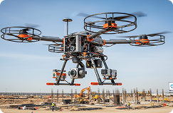
Construction Progress
Roof Inspection
Real Estate Photography
Mapping & Surveying
- Uncompromising Standards
Why Clients Choose Prewitt Drone Service
We approach every mission with a safety-first blueprint. From private estate photography to major infrastructural inspections, we maintain strict adherence to aviation protocols.
- Veteran-Owned Precision
- FAA Part 107 Certified
- Fully Insured $5M Liability
- State-of-the-Art DJI Fleet
- Rapid Data Delivery Turnaround
- Custom Thermal Inspection Scans
- Sub-Centimeter Accuracy
- 100% Satisfaction Guarantee
- Our Drone Services
Providing Strategic Data Across Critical Sectors
Our drone programs fit seamlessly into industrial workflows, speeding up
inspections and slashing insurance costs.
Energy
Utilities
Roofing
Insurance
Agriculture
Real Estate
Commercial
Government
Infrastructure
- Simple & Meticulous
Our Operational Flight Process
- 01
Request Quote
Submit your mission parameters
and project coordinates online
or by calling us.
- 02
Consultation
We map airspace clearances,
review safety checklists, and
set custom requirements.
- 03
Drone Flight
Part 107 pilots deploy advanced
enterprise hardware to securely
gather targeted visual data.
- 04
Receive Reports
Receive highly detailed reports,
high-res photos, and GIS
mapping models in record time.
- Proven Mission History
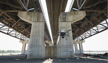
Featured Projects In Action
- Industrial Assets
Enterprise Technology Built For High-Precision Work
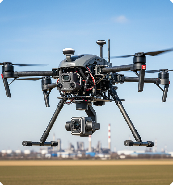
We field robust, calibrated commercial platforms ensuring flawless flight performance.
GPS RTK Core Tech
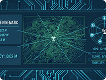
State-of-the-art satellite positioning giving real-time elevation coordinates.
Crystal-Clear 4K Optics
Active mechanical shutters designed for crisp, distortion-free orthomosaic mapping.
Enterprise Drone Systems
Equipped with advanced triple-redundant safety systems and RTK mapping accuracy.
Precision Thermal Imaging
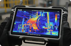
FLIR high-resolution thermal sensors to detect diagnostic heat loss or moisture spikes.
Advanced Mapping Software
Industry standard GIS rendering engines generating sub-centimeter volumetric outputs.
- Operational Feedback
What Partners Say About Our Precision
“The Prewitt crew mapped our entire 40-acre jobsite in hours. Their military discipline shines through. Flawless flight plans, detailed data deliverables.”

Col. Thomas Miller
VP Operations, Apex Build Group
“Stunning promotional videos that sold our lakefront development in 10 days. Exceptional professionalism, and outstanding drone skills.”

Sarah Jenkins
Founder, Peak Realty Trust
“The thermal scans of our substation caught a transformer anomaly before it went down. Unrivaled accuracy. Absolutely worth every penny.”

Robert Vance
Direct of Utilities, GridCore LLC
- Safety First Blueprint
Safety & Airspace Compliance Is Our Highest Priority
We operate under strict FAA regulations. All pilots are heavily vetted, Part 107 certified, and trained on military-grade hazard protocols.
FAA Part 107 Certified
Fully Licensed
Heavily Insured
Military Protocols
- Sector Insights
Latest Industry Intelligence
How Drone Mapping Saves Time
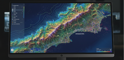
Traditional land surveys can take days. High-accuracy drone payloads deliver sub-centimeter point clouds in hours.
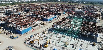
Why Construction Sites Use Drones
A detailed breakdown of volumetric photogrammetry models speeding up structural construction tracking timelines.
Top Drone Inspection Benefits
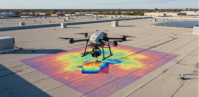
Learn how commercial enterprise drones dramatically reduce costly climbing hazards and pinpoint thermal roof anomalies.
- Help Desk
Frequently Asked Questions
Are Prewitt drone pilots FAA certified and insured?
Yes, every single pilot on our team holds an active FAA Part 107 certification. Prewitt Drone Service maintains a comprehensive commercial liability policy up to $5 Million.
What is your typical turnaround time for drone data deliverables?
Most visual standard commercial photos and raw cinematic video reels are processed and securely sent within 24 to 48 hours. GIS mapping and dense photogrammetry models usually take 48 to 72 hours.
Can you operate in restricted airspace near commercial airports?
Absolutely. We are fully equipped with LAANC real-time coordination technology to receive rapid airspace authorizations directly from FAA air traffic control.
Do you offer thermal scanning options for utility lines or roof systems?
Yes, our advanced fleet carries radiometric thermal sensors perfect for finding structural insulation leaks, flat roof anomalies, and high voltage transformer issues.
How are project quotes calculated?
Quotes are calculated precisely based on location complexity, required sensor packages (RGB vs. Thermal/RTK), flight duration, and requested data report layouts.
Need Professional Drone Services?
Let’s discuss your project today. We offer custom, compliant aerial strategies tailored
exactly to your industry goals.